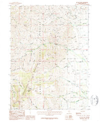
1986 Map of McAfee Peak
USGS Topo · Published 1987About this map
McAfee Peak rises as the central landmark of the Independence Mountains in this mid-1980s topographical study of Elko County. The landscape is defined by a dense network of watercourses and canyons, including the Humboldt River and McAfee Creek, which carve through the high elevations of the Humboldt National Forest. Land use in this era is reflected through practical infrastructure like the Radio Facility and a Gaging Station located along the river. For those researching the physical history of the range, the map documents established routes such as the Mill Creek Trail and East Fork Trail, providing a clear record of access to remote high-country features like Jeannette Lake and Rocky Bluff before modern developments. The drainage patterns of Beadles Creek, Sammy Creek, and Water Canyon illustrate the complex hydrology that feeds the region's ranching and wilderness areas.
Find a feature on this map
40 named features on this map. Tap any name to fly to it.
Don’t see what you’re looking for? This feature index may not catch every label — zoom into the map to look around manually.
Map Details
Editions of this 1986 McAfee Peak Map
This is the sole edition of this map. No revisions or reprints were ever made.
Other maps of this area

1955 · McDermitt
USGS Topo · 1:250,000

1955 · Wells
USGS Topo · 1:250,000

1956 · Tuscarora
USGS Topo · 1:62,500

1956 · Bull Run
USGS Topo · 1:62,500

1956 · Wild Horse
USGS Topo · 1:62,500

1958 · Wells
USGS Topo · 1:250,000

1959 · McDermitt
USGS Topo · 1:250,000

1961 · Wells
USGS Topo · 1:250,000

1971 · North Fork
USGS Topo · 1:24,000

1971 · California Mtn.
USGS Topo · 1:24,000