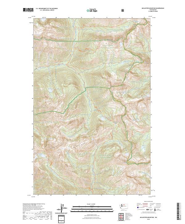
2023 Map of McAlester Mountain
USGS Topo · Published 2023About this map
Lyall Glacier sits at the northern edge of this high-altitude landscape, where the border between Chelan and Okanogan counties follows the crest of the Cascades. This area is defined by its extensive trail networks rather than roads, serving as a critical junction for the Pacific Crest National Scenic Trl as it winds near Bridge Creek. The map documents a complex protected wilderness system, including the North Cascades National Park and Stephen Mather Wilderness, where drainages like McAlester Creek and Rainbow Creek carve deep valleys between prominent summits.
Find a feature on this map
60 named features on this map. Tap any name to fly to it.
Don’t see what you’re looking for? This feature index may not catch every label — zoom into the map to look around manually.
Map Details
Editions of this 2023 McAlester Mountain Map
This is the sole edition of this map. No revisions or reprints were ever made.
Other maps of this area

1902 · Stehekin
USGS Topo · 1:125,000

1904 · Stehekin
USGS Topo · 1:125,000

1920 · Slate Pass
USGS Topo · 1:125,000

1955 · Concrete
USGS Topo · 1:250,000

1958 · Concrete
USGS Topo · 1:250,000

1962 · Concrete
USGS Topo · 1:250,000

1963 · Washington Pass
USGS Topo · 1:24,000

1963 · Mc Gregor Mtn
USGS Topo · 1:24,000
1963 · Mt. Arriva
USGS Topo · 1:24,000

1963 · Silver Star Mtn.
USGS Topo · 1:24,000