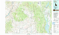
1980 Map of McCall
USGS Topo · Published 1993About this map
Hells Canyon and the winding corridor of the Snake River define the western reaches of this 1980 survey, where the Brownlee Reservoir and The Oxbow illustrate the significant hydroelectric developments at Oxbow Dam. This region of central Idaho and eastern Oregon is a landscape of profound verticality, transitioning from the river depths to the high peaks of Cuddy Mtn and the West Mountains.
Find a feature on this map
59 named features on this map. Tap any name to fly to it.
Don’t see what you’re looking for? This feature index may not catch every label — zoom into the map to look around manually.
Map Details
Editions of this 1980 McCall Map
2 editions found

Other maps of this area

1894 · Squaw Creek
USGS Topo · 1:125,000

1897 · Weiser
USGS Topo · 1:125,000

1909 · Garden Valley
USGS Topo · 1:125,000

1911 · Meadows
USGS Topo · 1:125,000

1915 · Pine
USGS Topo · 1:125,000

1920 · Seven Devils Mining District
USGS Topo · 1:48,000

1938 · Riggins
USGS Topo · 1:96,000

1945 · Riggins
USGS Topo · 1:125,000

1952 · Olds Ferry
USGS Topo · 1:62,500

1953 · Smiths Ferry
USGS Topo · 1:62,500