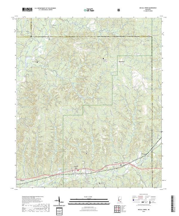
2024 Map of McCall Creek
USGS Topo · Published 2024About this map
The Homochitto National Forest encompasses much of this landscape, where the Homochitto River and its numerous tributaries like Molls Creek and Crooked Creek carve through the wooded terrain. Settlements are concentrated along the southern corridor, with the community of McCall Creek and nearby Lucien serving as local hubs. The area is marked by a network of rural roads such as Shucktown Rd and McCall Creek Rd, connecting small clusters of habitation and family landmarks. For those studying local lineage, the map identifies several burial grounds including Wrights Cem, New Salem Cem, and the Damascus Baptist Church Cem. The topography is defined by features like Pine Ridge, illustrating the classic timber-and-water character of the Lincoln and Franklin County borderlands.
Find a feature on this map
67 named features on this map. Tap any name to fly to it.
Don’t see what you’re looking for? This feature index may not catch every label — zoom into the map to look around manually.
Map Details
Editions of this 2024 McCall Creek Map
This is the sole edition of this map. No revisions or reprints were ever made.
Other maps of this area

1953 · Natchez
USGS Topo · 1:250,000

1956 · Natchez
USGS Topo · 1:250,000

1959 · Natchez
USGS Topo · 1:250,000

1962 · Bude
USGS Topo · 1:62,500

1963 · Union Church
USGS Topo · 1:62,500

1972 · West Lincoln
USGS Topo · 1:24,000

1972 · Midway
USGS Topo · 1:24,000

1972 · McCall Creek
USGS Topo · 1:24,000

1972 · Little Springs
USGS Topo · 1:24,000

1972 · Caseyville
USGS Topo · 1:24,000