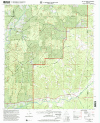
2000 Map of McCall Creek
USGS Topo · Published 2002About this map
The Homochitto National Forest dominates this section of southwest Mississippi, where the headwaters of the Homochitto River and McCall Creek carve through the timberlands. At the turn of the millennium, the map shows a landscape defined by timber management and rural crossroads, with the settlement of McCall Creek serving as a central point along the Lucien Road. The presence of Dummyline Road serves as a persistent geographic reminder of the region's logging history, tracing the path where old timber rails once ran.
Find a feature on this map
45 named features on this map. Tap any name to fly to it.
Don’t see what you’re looking for? This feature index may not catch every label — zoom into the map to look around manually.
Map Details
Editions of this 2000 McCall Creek Map
This is the sole edition of this map. No revisions or reprints were ever made.
Other maps of this area

1953 · Natchez
USGS Topo · 1:250,000

1956 · Natchez
USGS Topo · 1:250,000

1959 · Natchez
USGS Topo · 1:250,000

1962 · Bude
USGS Topo · 1:62,500

1963 · Union Church
USGS Topo · 1:62,500

1972 · West Lincoln
USGS Topo · 1:24,000

1972 · Midway
USGS Topo · 1:24,000

1972 · McCall Creek
USGS Topo · 1:24,000

1972 · Little Springs
USGS Topo · 1:24,000

1972 · Caseyville
USGS Topo · 1:24,000