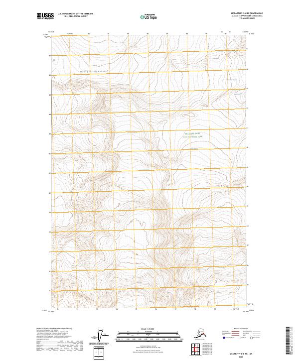
2023 Map of McCarthy C-6 NE
USGS Topo · Published 2023About this map
The Wrangell Mountains dominate this high-altitude Alaskan landscape, where the sheer scale of glacial movement defines the terrain. The sheet is primarily comprised of the Wrangell-St. Elias Wilderness and portions of the Wrangell-Saint Elias National Park, preserving an environment shaped by massive ice flows. Four distinct glaciers converge or terminate within these boundaries, most notably the expansive Kennicott Glacier and Root Glacier, which carve through the central and southern valleys. To the northeast, the ice-covered slopes of Regal Mtn feed the Regal Glacier and the headwaters of the Nabesna Glacier. The contour patterns reflect a vertical wilderness where traditional road networks are absent, replaced by a complex system of terminal moraines and alpine ridges that remain largely untouched by development in the twenty-first century.
Find a feature on this map
14 named features on this map. Tap any name to fly to it.
Don’t see what you’re looking for? This feature index may not catch every label — zoom into the map to look around manually.
Map Details
Editions of this 2023 McCarthy C-6 NE Map
This is the sole edition of this map. No revisions or reprints were ever made.
Other maps of this area

1951 · McCarthy
USGS Topo · 1:250,000

1959 · McCarthy C-5
USGS Topo · 1:63,360

1959 · McCarthy C-6
USGS Topo · 1:63,360

1960 · McCarthy D-6
USGS Topo · 1:63,360
1960 · McCarthy D-5
USGS Topo · 1:63,360

1960 · McCarthy
USGS Topo · 1:250,000
1993 · McCarthy C-6
USGS Topo · 1:63,360
1993 · McCarthy C-5
USGS Topo · 1:63,360
2017 · McCarthy C-5 SW
USGS Topo · 1:25,000
2017 · McCarthy C-6 NW
USGS Topo · 1:25,000