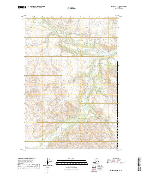
2023 Map of McCarthy D-1 NE
USGS Topo · Published 2023About this map
The Nutzotin Mountains dominate this high-altitude landscape in eastern Alaska, where the terrain is protected as part of the Wrangell-Saint Elias National Preserve. The map documents a rugged drainage system where Beaver Creek flows through the northern reaches, joined by tributaries such as Ptarmigan Creek. Further south, the headwaters of Rocker Creek carve through steep contours, reflecting the complex topography near the international border. This 2023 edition delineates the administrative boundary between the Southeast Fairbanks and Copper River Census Areas, providing a precise record of these uninhabited mountain ranges and their natural waterways at the start of the 21st century.
Find a feature on this map
13 named features on this map. Tap any name to fly to it.
Don’t see what you’re looking for? This feature index may not catch every label — zoom into the map to look around manually.
Map Details
Editions of this 2023 McCarthy D-1 NE Map
This is the sole edition of this map. No revisions or reprints were ever made.
Other maps of this area

1950 · Nabesna
USGS Topo · 1:250,000

1951 · McCarthy
USGS Topo · 1:250,000

1951 · Nabesna
USGS Topo · 1:250,000

1959 · McCarthy D-1
USGS Topo · 1:63,360

1959 · Nabesna A-1
USGS Topo · 1:63,360

1960 · Nabesna
USGS Topo · 1:250,000

1960 · McCarthy
USGS Topo · 1:250,000
2016 · Nabesna A-1 SE
USGS Topo · 1:25,000
2017 · McCarthy D-1 NW
USGS Topo · 1:25,000
2017 · McCarthy D-1 NE
USGS Topo · 1:25,000