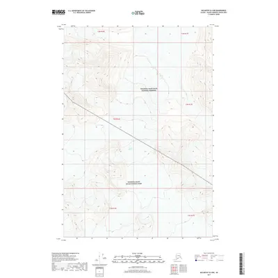
2017 Map of McCarthy D-4 NW
USGS Topo · Published 2017About this map
Chisana Glacier dominates the central portion of this remote Alaskan terrain, where high-altitude ice and steep topography define the border between two major federal designations. The northern half of the map is situated within the Wrangell-Saint Elias National Preserve, while the southern portion falls under the more strictly protected Wrangell-Saint Elias National Park. This 2017 survey reveals an environment shaped by massive glacial movement and seasonal melt, showing the intricate contour patterns of the interior Wrangell Mountains. The absence of roads or permanent settlements underscores the isolation of this high-wilderness area, where the landscape is navigated primarily by glacial features and the surveyed township lines of the Copper River Meridian.
Find a feature on this map
9 named features on this map. Tap any name to fly to it.
Don’t see what you’re looking for? This feature index may not catch every label — zoom into the map to look around manually.
Map Details
Editions of this 2017 McCarthy D-4 NW Map
This is the sole edition of this map. No revisions or reprints were ever made.
Other maps of this area

1950 · Nabesna
USGS Topo · 1:250,000

1951 · McCarthy
USGS Topo · 1:250,000

1951 · Nabesna
USGS Topo · 1:250,000

1959 · Nabesna A-4
USGS Topo · 1:63,360

1960 · Nabesna A-3
USGS Topo · 1:63,360

1960 · Nabesna
USGS Topo · 1:250,000
1960 · McCarthy D-5
USGS Topo · 1:63,360

1960 · McCarthy D-4
USGS Topo · 1:63,360

1960 · McCarthy
USGS Topo · 1:250,000
2016 · Nabesna A-3 SW
USGS Topo · 1:25,000