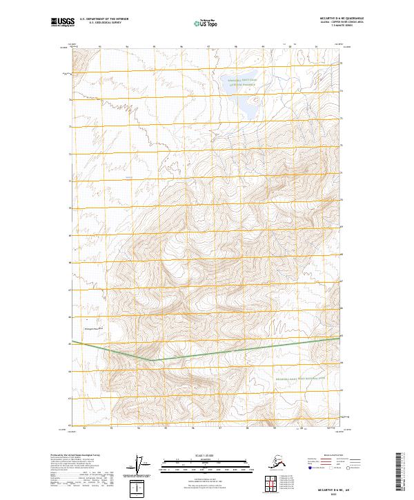
2023 Map of McCarthy D-6 NE
USGS Topo · Published 2023About this map
The Nabesna Glacier flows through this high-altitude landscape in the heart of the Wrangell Mountains, where extreme elevation and glacial movements define the terrain. This 2023 survey provides a modern look at the shifting ice and protected lands within the Wrangell-St. Elias Wilderness. The map highlights the complex jurisdictional boundaries of this region, encompassing portions of the Wrangell-Saint Elias National Preserve and the Wrangell-Saint Elias National Park. The topographic data captures the intricate ridge lines and steep vertical drops characteristic of this interior Alaskan range, illustrating the vast scale of one of the largest glacial systems in North America.
Find a feature on this map
11 named features on this map. Tap any name to fly to it.
Don’t see what you’re looking for? This feature index may not catch every label — zoom into the map to look around manually.
Map Details
Editions of this 2023 McCarthy D-6 NE Map
This is the sole edition of this map. No revisions or reprints were ever made.
Other maps of this area

1950 · Nabesna
USGS Topo · 1:250,000

1951 · McCarthy
USGS Topo · 1:250,000

1951 · Nabesna
USGS Topo · 1:250,000

1959 · Nabesna A-4
USGS Topo · 1:63,360

1959 · Nabesna A-5
USGS Topo · 1:63,360

1960 · McCarthy D-6
USGS Topo · 1:63,360

1960 · Nabesna
USGS Topo · 1:250,000
1960 · McCarthy D-5
USGS Topo · 1:63,360

1960 · McCarthy
USGS Topo · 1:250,000
2016 · Nabesna A-5 SE
USGS Topo · 1:25,000