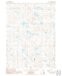
1986 Map of McCarthy Lake
USGS Topo · Published 1986About this map
Thompson Ranch and a network of family-held cattle operations define this high-plains landscape along the Morrill County and Garden County line during the mid-1980s. The terrain is characterized by a dense concentration of natural basins and water bodies, ranging from the central McCarthy Lake and Ryan Lake to the more distant Sturgeon Lake and Clear Lake in the north.
Find a feature on this map
23 named features on this map. Tap any name to fly to it.
Don’t see what you’re looking for? This feature index may not catch every label — zoom into the map to look around manually.
Map Details
Editions of this 1986 McCarthy Lake Map
This is the sole edition of this map. No revisions or reprints were ever made.
Other maps of this area

1896 · Browns Creek
USGS Topo · 1:125,000

1899 · Browns Creek
USGS Topo · 1:125,000

1947 · Alliance
USGS Topo · 1:24,000

1948 · Alliance
USGS Topo · 1:24,000

1948 · Antioch
USGS Topo · 1:62,500

1949 · Lynn
USGS Topo · 1:62,500

1949 · Antioch
USGS Topo · 1:62,500

1950 · Storm Lake
USGS Topo · 1:62,500

1954 · Scottsbluff
USGS Topo · 1:250,000

1955 · Alliance
USGS Topo · 1:250,000