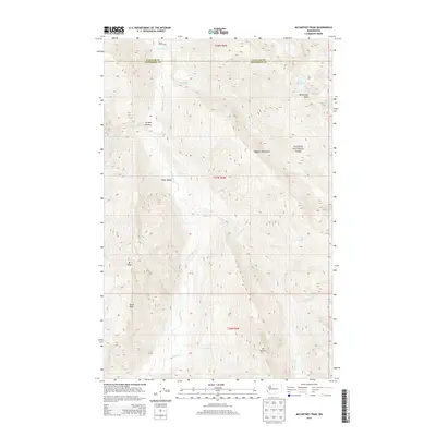
2014 Map of McCartney Peak
USGS Topo · Published 2014About this map
Olympic National Park defines this landscape, where the high ridges of the Olympic Mountains meet a complex drainage system of major rivers and alpine basins. The Elwha River flows northward through the center of the sheet, joined by tributaries like the Goldie River and Hayes River that have carved deep valleys such as Press Valley. High-elevation landmarks like McCartney Peak and Mt Dana dominate the horizon, with the presence of the Lillian Glacier near Lake Lillian indicating the cold, perennial snowpack characteristic of these peaks. Grounded in the wilderness character of the early 21st century, the map shows minimal human infrastructure beyond the Stony Point Camp in the north and the high-altitude Semple Plateau. This survey captures the remote headwaters and interior summits along the boundary of Clallam and Jefferson Counties before modern environmental changes altered these glacial features.
Find a feature on this map
24 named features on this map. Tap any name to fly to it.
Don’t see what you’re looking for? This feature index may not catch every label — zoom into the map to look around manually.
Map Details
Editions of this 2014 McCartney Peak Map
This is the sole edition of this map. No revisions or reprints were ever made.
Other maps of this area

1935 · Mount Olympus
USGS Topo · 1:62,500

1938 · Mt Constance
USGS Topo · 1:125,000

1942 · Mount Olympus
USGS Topo · 1:62,500

1944 · Mt. Angeles
USGS Topo · 1:62,500

1946 · Mt. Angeles
USGS Topo · 1:62,500

1947 · Mt. Steel
USGS Topo · 1:62,500

1947 · Mt Christie
USGS Topo · 1:62,500

1950 · Mt Christie
USGS Topo · 1:62,500

1950 · Mt. Steel
USGS Topo · 1:62,500

1950 · Hurricane Hill
USGS Topo · 1:24,000