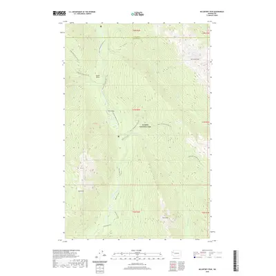
2020 Map of McCartney Peak
USGS Topo · Published 2020About this map
Olympic National Park defines this landscape of high peaks and river headwaters at the border of Clallam and Jefferson counties. The topography is dominated by the massive presence of McCartney Peak and Mt Dana, with the Semple Plateau providing a rare break in the vertical relief. This area serves as a critical hydrological hub, where the Elwha River and Hayes River converge, fed by tributaries like Stony Creek and Godkin Creek. For researchers of backcountry history, the map provides an exact routing of the Pacific NW National Scenic Trail as it traverses Press Valley and follows the ridges between the Lillian River and Goldie River. The presence of the Dodger Point Primitive Trail and the Elwha River Trail indicates the long-standing importance of this wilderness corridor for high-altitude passage through the Olympic interior.
Find a feature on this map
27 named features on this map. Tap any name to fly to it.
Don’t see what you’re looking for? This feature index may not catch every label — zoom into the map to look around manually.
Map Details
Editions of this 2020 McCartney Peak Map
This is the sole edition of this map. No revisions or reprints were ever made.
Other maps of this area

1935 · Mount Olympus
USGS Topo · 1:62,500

1938 · Mt Constance
USGS Topo · 1:125,000

1942 · Mount Olympus
USGS Topo · 1:62,500

1944 · Mt. Angeles
USGS Topo · 1:62,500

1946 · Mt. Angeles
USGS Topo · 1:62,500

1947 · Mt. Steel
USGS Topo · 1:62,500

1947 · Mt Christie
USGS Topo · 1:62,500

1950 · Mt Christie
USGS Topo · 1:62,500

1950 · Mt. Steel
USGS Topo · 1:62,500

1950 · Hurricane Hill
USGS Topo · 1:24,000