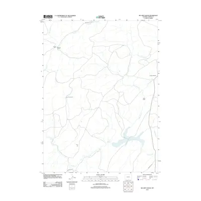
2012 Map of McCarty Ranch
USGS Topo · Published 2012About this map
McCarty Ranch and the Sundin Johnson Ranch define the settled landscape of this high-altitude Carbon County region, where ranching operations depend on the complex drainage network of the Savery Cr. The terrain is deeply carved by the N Fork Savery Cr and Little Savery Cr, while landmarks like Smiley Meadow and Deep Gulch suggest a landscape used for seasonal grazing and transport. High-elevation connectivity is maintained via McCarty Canyon Rd and Browns Hill Rd, which provide access through the rugged McCarty Canyon. This 2012 snapshot reflects the contemporary state of these isolated ranching outposts, documenting the perennial water sources and access routes that have sustained land use in southern Wyoming for generations.
Find a feature on this map
16 named features on this map. Tap any name to fly to it.
Don’t see what you’re looking for? This feature index may not catch every label — zoom into the map to look around manually.
Map Details
Editions of this 2012 McCarty Ranch Map
This is the sole edition of this map. No revisions or reprints were ever made.
Other maps of this area

1932 · Savery
USGS Topo · 1:96,000

1940 · Savery
USGS Topo · 1:125,000

1954 · Rawlins
USGS Topo · 1:250,000

1958 · Rawlins
USGS Topo · 1:250,000

1961 · Divide Peak
USGS Topo · 1:24,000

1961 · Middlewood Hill
USGS Topo · 1:24,000

1961 · Pine Grove Ranch
USGS Topo · 1:24,000
1961 · Browns Hill
USGS Topo · 1:24,000

1961 · Ketchum Buttes
USGS Topo · 1:24,000

1961 · Pole Gulch
USGS Topo · 1:24,000