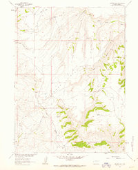
1961 Map of Browns Hill
USGS Topo · Published 1963About this map
Browns Hill and the surrounding high country of Carbon County are documented here as they appeared in the early 1960s. This land was mapped as part of a Department of the Interior program for the development of the Missouri River Basin, revealing a landscape defined by seasonal water sources and livestock management. Small hubs of activity like Stratton Corral and the Browning location suggest the ranching patterns of the era, where isolated outposts served as critical points in the open range.
Find a feature on this map
17 named features on this map. Tap any name to fly to it.
Don’t see what you’re looking for? This feature index may not catch every label — zoom into the map to look around manually.
Map Details
Editions of this 1961 Browns Hill Map
2 editions found
Other maps of this area

1932 · Savery
USGS Topo · 1:96,000

1940 · Savery
USGS Topo · 1:125,000

1954 · Rawlins
USGS Topo · 1:250,000

1957 · Baggs
USGS Topo · 1:62,500

1957 · Doty Mountain
USGS Topo · 1:62,500

1958 · Rawlins
USGS Topo · 1:250,000
1961 · Savery
USGS Topo · 1:24,000

1961 · Ketchum Buttes
USGS Topo · 1:24,000

1961 · Grieve Reservoir
USGS Topo · 1:24,000
1961 · Tullis
USGS Topo · 1:24,000