
1961 Map of Grieve Reservoir
USGS Topo · Published 1963About this map
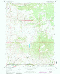
The Little Snake River defines the southern boundary of this 1961 survey, where the borders of Wyoming and Colorado meet alongside Carbon, Moffat, and Routt counties. This high-altitude ranching landscape is characterized by its seasonal movement of livestock, evidenced by the Stock Driveway and specialized locations like the Savery Corral and Divide Hdqrs Corral. At the center of the sheet, the Grieve Reservoir sits tucked between Horse Mountain and Little Horse Mountain, serving as a vital water source for the arid Reader Basin. Local infrastructure supporting the small community includes the Battle Creek Sch and the Anderson Cem near the river, while the Medicine Bow National Forest covers the eastern elevations. Remnants of early homesteading and range management appear throughout, from the Boyer Ranch in the north to the Belvidere Ditch, which channels water across the broken terrain.
Find a feature on this map
32 named features on this map. Tap any name to fly to it.
Don’t see what you’re looking for? This feature index may not catch every label — zoom into the map to look around manually.
Map Details
Editions of this 1961 Grieve Reservoir Map
2 editions found
Other maps of this area

1932 · Savery
USGS Topo · 1:96,000

1940 · Savery
USGS Topo · 1:125,000

1954 · Rawlins
USGS Topo · 1:250,000

1954 · Craig
USGS Topo · 1:250,000

1957 · Craig
USGS Topo · 1:250,000

1958 · Rawlins
USGS Topo · 1:250,000

1958 · Craig
USGS Topo · 1:250,000

1960 · Craig
USGS Topo · 1:250,000
1961 · Savery
USGS Topo · 1:24,000
1961 · Browns Hill
USGS Topo · 1:24,000