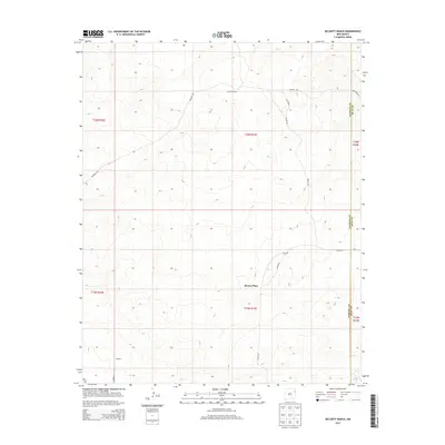
2013 Map of McCarty Ranch
USGS Topo · Published 2013About this map
McCarty Ranch anchors this high plains landscape on the border of Harding and Quay counties, reflecting the enduring ranching tradition of eastern New Mexico. The terrain is marked by isolated homesteads and stopping points like Brown Place and the small settlement at Webster. A network of unpaved tracks, including Rosebud Rd and McCarty Rd, connects these remote outposts across a landscape defined by subtle topographic shifts and essential water sources such as East Sand Springs. The map illustrates the sparse, grid-based distribution of property and access that characterizes the Llano Estacado region, where vast distances are bridged by named county roads like Helms Rd and Bruhn Rd.
Find a feature on this map
19 named features on this map. Tap any name to fly to it.
Don’t see what you’re looking for? This feature index may not catch every label — zoom into the map to look around manually.
Map Details
Editions of this 2013 McCarty Ranch Map
This is the sole edition of this map. No revisions or reprints were ever made.
Other maps of this area

1930 · Tucumcari
USGS Topo · 1:125,000

1954 · Tucumcari
USGS Topo · 1:250,000

1958 · Tucumcari
USGS Topo · 1:250,000

1962 · Logan
USGS Topo · 1:62,500

1966 · Cherokee Valley
USGS Topo · 1:24,000

1966 · Lockney
USGS Topo · 1:24,000

1966 · Mc Carty Ranch
USGS Topo · 1:24,000

1966 · Mc Cloy Ranch
USGS Topo · 1:24,000

1968 · Montesito Creek
USGS Topo · 1:24,000

1969 · Gallegos NE
USGS Topo · 1:24,000