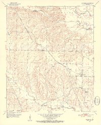
1951 Map of McCaskill
USGS Topo · Published 1952About this map
McCaskill and the rolling terrain of Redland and Thompson townships dominate this early 1950s survey at the border of Pike and Hempstead counties. The Prescott and Northwestern railroad cuts through the landscape, serving a region defined by scattered rural communities and creek-side agriculture. Numerous country churches and cemeteries, including Avery Chapel, New Home Ch, and the Young Cem, are documented here, alongside a Lookout Tower and Blevins Sch No 2.
Find a feature on this map
25 named features on this map. Tap any name to fly to it.
Don’t see what you’re looking for? This feature index may not catch every label — zoom into the map to look around manually.
Map Details
Editions of this 1951 McCaskill Map
3 editions found
Other maps of this area

1906 · Caddo Gap
USGS Topo · 1:125,000

1951 · Blevins
USGS Topo · 1:24,000

1951 · Columbus
USGS Topo · 1:24,000

1951 · Nashville
USGS Topo · 1:24,000

1951 · Washington
USGS Topo · 1:24,000

1951 · Pisgah
USGS Topo · 1:24,000

1951 · McCaskill
USGS Topo · 1:24,000

1953 · El Dorado
USGS Topo · 1:250,000

1955 · Little Rock
USGS Topo · 1:250,000

1956 · Little Rock
USGS Topo · 1:250,000