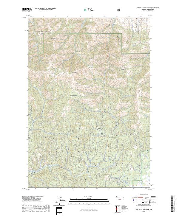
2023 Map of McClellan Mountain
USGS Topo · Published 2023About this map
Aldrich Mountains and the high peaks of the Malheur National Forest define this landscape in Grant County. The area is marked by significant topographical variation, including First Peak, Second Peak, and the prominent McClellan Mtn. This map captures the intricate drainage network of the region, where waters flow through McClellan Creek and Murderers Creek.
Find a feature on this map
47 named features on this map. Tap any name to fly to it.
Don’t see what you’re looking for? This feature index may not catch every label — zoom into the map to look around manually.
Map Details
Editions of this 2023 McClellan Mountain Map
This is the sole edition of this map. No revisions or reprints were ever made.
Other maps of this area

1940 · Mount Vernon
USGS Topo · 1:62,500

1940 · Aldrich Mtn.
USGS Topo · 1:62,500

1943 · Aldrich Mtn.
USGS Topo · 1:62,500

1943 · Mount Vernon
USGS Topo · 1:62,500

1955 · Canyon City
USGS Topo · 1:250,000

1959 · Canyon City
USGS Topo · 1:250,000

1961 · Logdell
USGS Topo · 1:62,500

1961 · Izee
USGS Topo · 1:62,500

1972 · Big Weasel Sprs
USGS Topo · 1:24,000
1972 · Mc Clellan Mtn
USGS Topo · 1:24,000