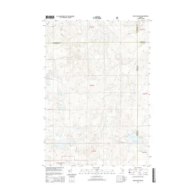
2014 Map of McCollum Lake
USGS Topo · Published 2014About this map
The Upper South Branch Thunder Bay River meanders through this portion of the Huron National Forest, where the corners of Alpena, Alcona, Montmorency, and Oscoda counties meet. This 2014 survey captures a landscape defined by an intricate network of glacial lakes and wetlands, including McCollum Lake, Port Wine Lake, and the connected Big Ward Lake and Little Ward Lake. The area's human history is marked by the Mooney Cem near Black Rd, while its recreational character is evidenced by the numerous named lakes like Saddleback Lake and Island Lake. A grid of forest roads, such as Saddleback Lake Rd and Durkee Lake Rd, provides access to this aquatic landscape where creeks like Pike Cr and McGinn Cr drain the sandy interior.
Find a feature on this map
46 named features on this map. Tap any name to fly to it.
Don’t see what you’re looking for? This feature index may not catch every label — zoom into the map to look around manually.
Map Details
Editions of this 2014 McCollum Lake Map
This is the sole edition of this map. No revisions or reprints were ever made.
Other maps of this area

1954 · Traverse City
USGS Topo · 1:250,000

1954 · Tawas City
USGS Topo · 1:250,000

1955 · Comins
USGS Topo · 1:62,500

1958 · Traverse City
USGS Topo · 1:250,000

1958 · Tawas City
USGS Topo · 1:250,000

1972 · McKinley
USGS Topo · 1:24,000

1972 · Curran
USGS Topo · 1:24,000

1972 · McCollum Lake
USGS Topo · 1:24,000
1972 · Beaver Lake
USGS Topo · 1:24,000
1972 · Rust
USGS Topo · 1:24,000