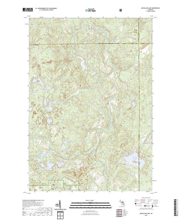
2023 Map of McCollum Lake
USGS Topo · Published 2023About this map
Huron National Forest lands dominate this northern Michigan landscape, characterized by an intricate network of kettle lakes and wetlands at the junction of Oscoda, Alcona, Montmorency, and Alpena counties. The hydrological patterns are defined by the Upper South Branch Thunder Bay River, which meanders through the eastern portion of the survey. Significant water bodies like McCollum Lake and Port Wine Lake provide focal points for local geography, while smaller features such as Saddleback Lake and Big Ward Lake are linked by seasonal streams like Bullock Creek and Pike Creek. Social history is anchored at the Mooney Cem near the intersection of Hopkins Rd and Co Hwy 607. This modern survey illustrates how decades of conservation and forestry management have preserved the primitive character of the terrain, while maintaining a grid of forest service roads and local routes like Flynn Valley Rd.
Find a feature on this map
51 named features on this map. Tap any name to fly to it.
Don’t see what you’re looking for? This feature index may not catch every label — zoom into the map to look around manually.
Map Details
Editions of this 2023 McCollum Lake Map
This is the sole edition of this map. No revisions or reprints were ever made.
Other maps of this area

1954 · Traverse City
USGS Topo · 1:250,000

1954 · Tawas City
USGS Topo · 1:250,000

1955 · Comins
USGS Topo · 1:62,500

1958 · Traverse City
USGS Topo · 1:250,000

1958 · Tawas City
USGS Topo · 1:250,000

1972 · McKinley
USGS Topo · 1:24,000

1972 · Curran
USGS Topo · 1:24,000

1972 · McCollum Lake
USGS Topo · 1:24,000
1972 · Beaver Lake
USGS Topo · 1:24,000
1972 · Rust
USGS Topo · 1:24,000