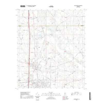
2018 Map of McComb North
USGS Topo · Published 2018About this map
McComb and Summit serve as the primary anchors of this southern Mississippi landscape, situated at the border of Lincoln and Pike counties. The area is characterized by a dense distribution of rural burial grounds, such as Dickerson Cem and Old Friendship Cem, which reflect the long-standing family and community ties of the region. The Southwest Mississippi Community College campus is a prominent landmark north of Summit, while the northern portion of the sheet is marked by the recreational waters of Dixie Springs Lake. Waterways including the Bogue Chitto and Little Tangipahoa River drain the rolling terrain, defining the natural boundaries between woodlots and residential development. These physical features, combined with named roads like Alford Bridge Rd and Old Brookhaven Rd, reveal a traditional settlement pattern that has evolved around the central rail and road corridors.
Find a feature on this map
190 named features on this map. Tap any name to fly to it.
Don’t see what you’re looking for? This feature index may not catch every label — zoom into the map to look around manually.
Map Details
Editions of this 2018 McComb North Map
This is the sole edition of this map. No revisions or reprints were ever made.
Other maps of this area

1953 · Natchez
USGS Topo · 1:250,000

1956 · Natchez
USGS Topo · 1:250,000

1959 · Natchez
USGS Topo · 1:250,000

1972 · West Lincoln
USGS Topo · 1:24,000

1972 · Auburn
USGS Topo · 1:24,000

1972 · Ruth
USGS Topo · 1:24,000

1972 · Pricedale
USGS Topo · 1:24,000

1972 · Bogue Chitto
USGS Topo · 1:24,000

1972 · McComb South
USGS Topo · 1:24,000

1972 · Lake Tangipahoa
USGS Topo · 1:24,000