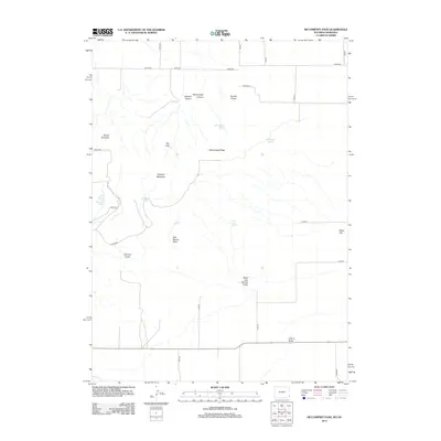
2012 Map of McCompsey Pass
USGS Topo · Published 2012About this map
Sixtysix Mountain and McCompsey Pass dominate this high-plains landscape along the Wyoming and Nebraska border. This 2012 survey documents a terrain defined by its water sources and sharp relief, where named springs like Huntington Springs, Bull Pasture Spring, and State Line Springs provide essential hydration points in an otherwise arid environment. The naming of landmarks like Devils Armchair, The Culp, and Double Hump suggests a long history of local navigation and land-marking by residents and travelers passing through the breaks. The network of canyons and draws, including Driscoll Canyon and McCompsey Canyon, illustrates the complex drainage patterns feeding into the surrounding flats. This map serves as a precise record of the rural road network, from Road 28 to the various county roads that stitch together these remote rangelands.
Find a feature on this map
36 named features on this map. Tap any name to fly to it.
Don’t see what you’re looking for? This feature index may not catch every label — zoom into the map to look around manually.
Map Details
Editions of this 2012 McCompsey Pass Map
This is the sole edition of this map. No revisions or reprints were ever made.
Other maps of this area

1898 · Scotts Bluff
USGS Topo · 1:125,000

1899 · Goshen Hole
USGS Topo · 1:125,000

1954 · Scottsbluff
USGS Topo · 1:250,000

1954 · Cheyenne
USGS Topo · 1:250,000

1958 · Cheyenne
USGS Topo · 1:250,000

1958 · Scottsbluff
USGS Topo · 1:250,000

1960 · Tremain
USGS Topo · 1:24,000

1960 · Mc Compsey Pass
USGS Topo · 1:24,000

1960 · Petsch Reservoir
USGS Topo · 1:24,000

1960 · Stegall
USGS Topo · 1:24,000