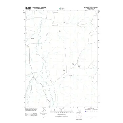
2012 Map of McConaughy Gulch
USGS Topo · Published 2012About this map
Scott Valley dominates the western portion of this Siskiyou County landscape, where the meandering Scott River serves as the primary drainage for numerous gulches and creeks descending from the surrounding heights. The settlement pattern here is dictated by this topography, with legacy infrastructure like the Douglas School and various ranch roads situated along the valley floor. Waterways such as French Cr, Etna Cr, and Clark Cr feed into the river system, while the eastern terrain is defined by a series of steep drainages including Indian Gulch and the prominent Mcconaughy Gulch. Transport routes like Eastside Rd and Mcconaughy Gulch Rd follow the natural contours, providing access to more remote landmarks such as Denny Point. This survey captures the rural character of the region, where family names are often preserved in the labeling of the gulches and spurs that mark the hillsides.
Find a feature on this map
31 named features on this map. Tap any name to fly to it.
Don’t see what you’re looking for? This feature index may not catch every label — zoom into the map to look around manually.
Map Details
Editions of this 2012 McConaughy Gulch Map
This is the sole edition of this map. No revisions or reprints were ever made.
Other maps of this area

1886 · Shasta
USGS Topo · 1:250,000

1894 · Shasta
USGS Topo · 1:250,000

1923 · Sawyers Bar
USGS Topo · 1:125,000

1931 · Etna
USGS Topo · 1:96,000

1932 · Yreka
USGS Topo · 1:96,000

1934 · Etna
USGS Topo · 1:125,000

1939 · Yreka
USGS Topo · 1:125,000

1948 · Weed
USGS Topo · 1:250,000

1950 · Weed
USGS Topo · 1:250,000

1954 · Yreka
USGS Topo · 1:62,500