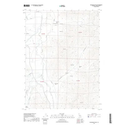
2018 Map of McConaughy Gulch
USGS Topo · Published 2018About this map
Scott Valley dominates the western portion of this 2018 survey, where the Scott River meanders through a broad floor of agricultural parcels and riparian wetlands. This fertile valley floor contrasts sharply with the steep, drainage-carved terrain to the east, which is defined by a series of prominent gulches including Heartstrand Gulch, Weston Gulch, and McConaughy Gulch. The landscape transition provides a clear view of how land use in Siskiyou County is dictated by geography, with ranching roads like Timmons Ranch Rd and Eastside Rd skirting the valley edge.
Find a feature on this map
36 named features on this map. Tap any name to fly to it.
Don’t see what you’re looking for? This feature index may not catch every label — zoom into the map to look around manually.
Map Details
Editions of this 2018 McConaughy Gulch Map
This is the sole edition of this map. No revisions or reprints were ever made.
Other maps of this area

1886 · Shasta
USGS Topo · 1:250,000

1894 · Shasta
USGS Topo · 1:250,000

1923 · Sawyers Bar
USGS Topo · 1:125,000

1931 · Etna
USGS Topo · 1:96,000

1932 · Yreka
USGS Topo · 1:96,000

1934 · Etna
USGS Topo · 1:125,000

1939 · Yreka
USGS Topo · 1:125,000

1948 · Weed
USGS Topo · 1:250,000

1950 · Weed
USGS Topo · 1:250,000

1954 · Yreka
USGS Topo · 1:62,500