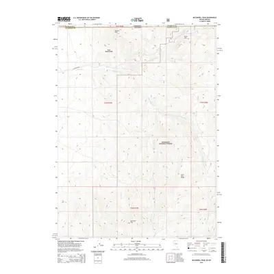
2015 Map of McConnell Peak
USGS Topo · Published 2015About this map
Fort McDermitt serves as the focal point of this high-desert landscape where the Great Basin terrain meets the Oregon-Nevada state line. The survey captures the complex drainage of the Quinn River system, including the E Fork Quinn River and the S Fork Quinn River, which wind through the northern reaches of the Humboldt National Forest. The topography is dominated by the striking peaks of the Santa Rosa Range, with McConnell Peak and Minerva Peak providing significant vertical relief against the valley floors.
Find a feature on this map
21 named features on this map. Tap any name to fly to it.
Don’t see what you’re looking for? This feature index may not catch every label — zoom into the map to look around manually.
Map Details
Editions of this 2015 McConnell Peak Map
This is the sole edition of this map. No revisions or reprints were ever made.
Other maps of this area

1882 · Paradise
USGS Topo · 1:250,000

1893 · Paradise
USGS Topo · 1:250,000

1955 · McDermitt
USGS Topo · 1:250,000

1955 · Jordan Valley
USGS Topo · 1:250,000

1957 · Jordan Valley
USGS Topo · 1:250,000

1958 · Jordan Valley
USGS Topo · 1:250,000

1959 · McDermitt
USGS Topo · 1:250,000

1959 · McDermitt
USGS Topo · 1:62,500

1980 · Odell Mountain
USGS Topo · 1:24,000
1980 · Holloway Meadows
USGS Topo · 1:24,000