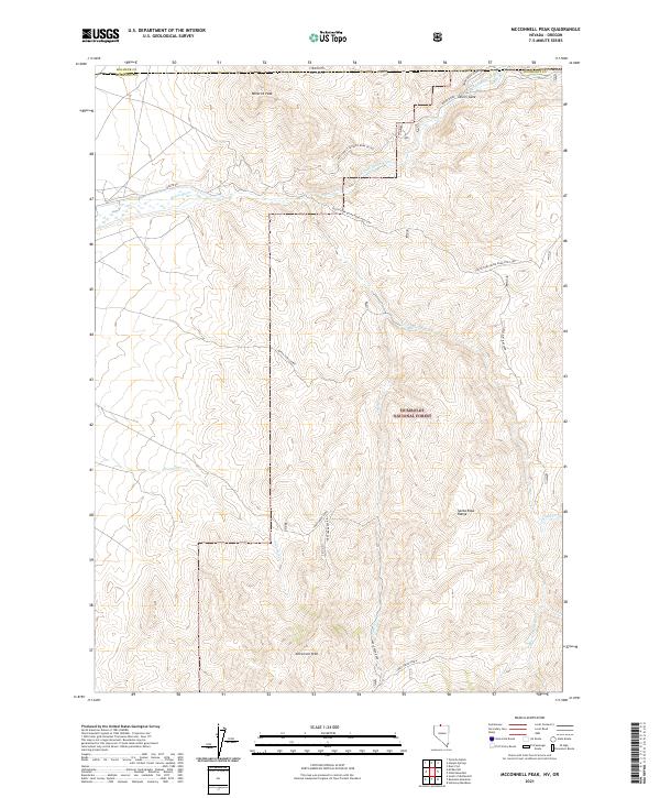
2021 Map of McConnell Peak
USGS Topo · Published 2021About this map
McConnell Peak stands as the primary landmark in this section of the northern Santa Rosa Range, where the high desert terrain of Humboldt County meets the Oregon state line. The landscape is defined by the headwaters of the Quinn River, including the E-Fork Quinn River and S-Fork Quinn River which converge near Devils Gate. Much of the southern and central portions of the map are protected within the Humboldt National Forest, characterized by a network of forest service tracks and specialized infrastructure such as the Odell Pipeline Spur C. The area's drainage pattern is well-defined by seasonal watercourses like Twomile Cr and Chicken Cr, which flow through deep canyons and high ridges including Minerva Peak. A remote network of ranch and forest roads, such as Jakes Creek Road and the North Rd, provides the only access through this isolated high-elevation environment.
Find a feature on this map
31 named features on this map. Tap any name to fly to it.
Don’t see what you’re looking for? This feature index may not catch every label — zoom into the map to look around manually.
Map Details
Editions of this 2021 McConnell Peak Map
This is the sole edition of this map. No revisions or reprints were ever made.
Other maps of this area

1882 · Paradise
USGS Topo · 1:250,000

1893 · Paradise
USGS Topo · 1:250,000

1955 · McDermitt
USGS Topo · 1:250,000

1955 · Jordan Valley
USGS Topo · 1:250,000

1957 · Jordan Valley
USGS Topo · 1:250,000

1958 · Jordan Valley
USGS Topo · 1:250,000

1959 · McDermitt
USGS Topo · 1:250,000

1959 · McDermitt
USGS Topo · 1:62,500

1980 · Odell Mountain
USGS Topo · 1:24,000
1980 · Holloway Meadows
USGS Topo · 1:24,000