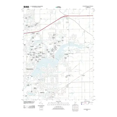
2010 Map of McCordsville
USGS Topo · Published 2010About this map
Geist Reservoir and its surrounding suburbs dominate this landscape northeast of Indianapolis, showing the intensive residential development of the early 21st century. The map documents an intricate network of modern subdivisions such as Windermere Pointe, Heritage Green, and Spyglass Hill, which have reshaped the terrain around the water. Despite this suburban growth, several historic burial grounds like Bethlehem Cemetery and Lowery Cemetery remain preserved amidst the expanding street grid.
Find a feature on this map
120 named features on this map. Tap any name to fly to it.
Don’t see what you’re looking for? This feature index may not catch every label — zoom into the map to look around manually.
Map Details
Editions of this 2010 McCordsville Map
This is the sole edition of this map. No revisions or reprints were ever made.
Other maps of this area

1948 · Indianapolis East
USGS Topo · 1:24,000

1952 · Cumberland
USGS Topo · 1:24,000

1952 · Greenfield
USGS Topo · 1:24,000

1952 · Fishers
USGS Topo · 1:24,000

1952 · Ingalls
USGS Topo · 1:24,000

1952 · Mc Cordsville
USGS Topo · 1:24,000

1953 · Lapel
USGS Topo · 1:24,000

1953 · Riverwood
USGS Topo · 1:24,000

1953 · Noblesville
USGS Topo · 1:24,000

1953 · Cincinnati
USGS Topo · 1:250,000