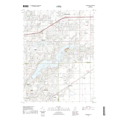
2019 Map of McCordsville
USGS Topo · Published 2019About this map
Geist Reservoir dominates the landscape at the meeting of Hamilton, Marion, and Hancock counties, its irregular shoreline creating a complex geography of suburban expansion and natural drainage. To the south, the community of Oaklandon and the adjacent McCordsville are centered along the historic Pendleton Pike corridor. This area showcases the transition from agricultural land to residential developments like Luxhaven and Hawthorn Hills, while still preserving numerous small family and community burial grounds including Old Oaklandon Cem and McCord Cem. The intricate network of waterways, featuring Bee Camp Cr and Stansbury Ditch, illustrates the careful water management required as the suburbs of Fishers and Lawrence expanded. Researchers can find distinct pockets of earlier settlement at Woodbury and around Indian Lake, providing a clear look at the region’s development patterns in the late 2010s.
Find a feature on this map
57 named features on this map. Tap any name to fly to it.
Don’t see what you’re looking for? This feature index may not catch every label — zoom into the map to look around manually.
Map Details
Editions of this 2019 McCordsville Map
This is the sole edition of this map. No revisions or reprints were ever made.
Other maps of this area

1948 · Indianapolis East
USGS Topo · 1:24,000

1952 · Cumberland
USGS Topo · 1:24,000

1952 · Greenfield
USGS Topo · 1:24,000

1952 · Fishers
USGS Topo · 1:24,000

1952 · Ingalls
USGS Topo · 1:24,000

1952 · Mc Cordsville
USGS Topo · 1:24,000

1953 · Lapel
USGS Topo · 1:24,000

1953 · Riverwood
USGS Topo · 1:24,000

1953 · Noblesville
USGS Topo · 1:24,000

1953 · Cincinnati
USGS Topo · 1:250,000