2022 Map of McCordsville
USGS Topo · Published 2022About this map
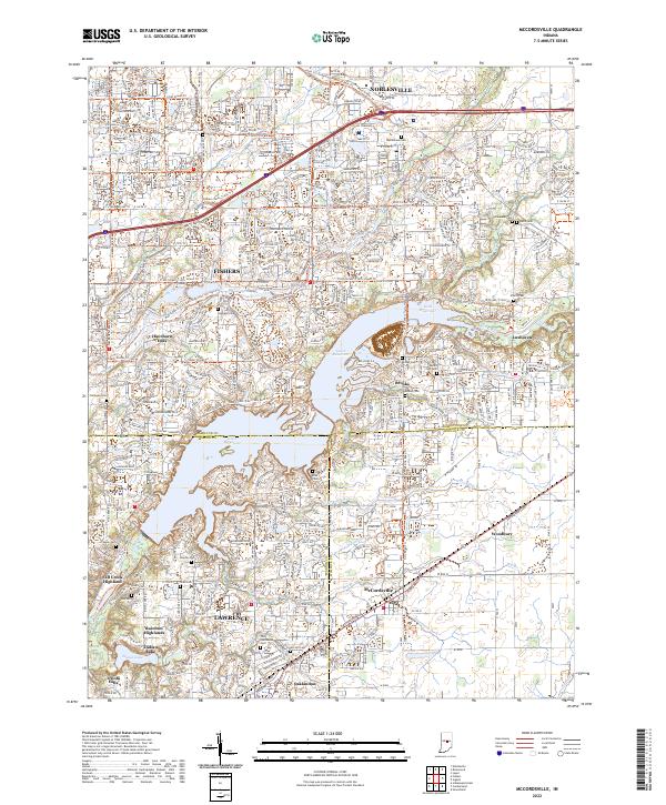
Geist Reservoir dominates the central landscape of this Indiana region, where the borders of Hamilton, Marion, and Hancock counties converge. The suburban expansion of Fishers, Lawrence, and Noblesville is evident through an extensive network of multi-use paths such as the 146th St / Greenfield Ave Corridor Trl and the Mud Creek / Sand Creek Greenway Corridor Trl. Despite this modern development, the map preserves significant genealogical data through numerous small burial grounds, including Bethlehem Cem, Kinnaman Cem, and Mount Zion Cem. The southern portion of the map highlights established residential clusters like Oaklandon and McCordsville alongside natural drainage features such as Buck Cr and Stansbury Ditch. This geography illustrates the transformation of rural farmland and creek valleys into a structured suburban corridor while maintaining the original footprint of local family history.
Find a feature on this map
66 named features on this map. Tap any name to fly to it.
Don’t see what you’re looking for? This feature index may not catch every label — zoom into the map to look around manually.
Map Details
Editions of this 2022 McCordsville Map
This is the sole edition of this map. No revisions or reprints were ever made.
Historical Maps of Germantown Through Time
1 maps found