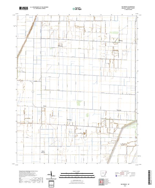
2024 Map of McCormick
USGS Topo · Published 2024About this map
McCormick and the surrounding Poinsett County landscape are defined by the rigid geometry of the Public Land Survey System, where a dense network of farm roads and drainage channels dictates the human geography. The area reflects a deep-rooted agricultural heritage, illustrated by the proximity of Old Weona and the newer Weona settlement. The reliance on water management for this low-lying delta terrain is visible in features like the Oak Donnick Floodway and several managed waterways, such as Red Ditch Ln E. Small clusters of development at Judd Hill and Payneway are linked by a grid of numbered county roads, showcasing a resilient rural community structure where every section of land is utilized. This survey provides a clear view of the modern road network, including family-named routes like Taylor Rd and Henderson Ln, which likely serve as modern markers for ancestral family holdings.
Find a feature on this map
55 named features on this map. Tap any name to fly to it.
Don’t see what you’re looking for? This feature index may not catch every label — zoom into the map to look around manually.
Map Details
Editions of this 2024 McCormick Map
This is the sole edition of this map. No revisions or reprints were ever made.
Other maps of this area

1940 · Deckerville
USGS Topo · 1:62,500

1940 · Princedale
USGS Topo · 1:62,500

1940 · Dee
USGS Topo · 1:62,500

1941 · Marked Tree
USGS Topo · 1:62,500

1953 · Memphis
USGS Topo · 1:250,000

1956 · Marked Tree
USGS Topo · 1:62,500

1956 · Memphis
USGS Topo · 1:250,000

1956 · Princedale
USGS Topo · 1:62,500

1957 · Deckerville
USGS Topo · 1:62,500

1958 · Dee
USGS Topo · 1:62,500