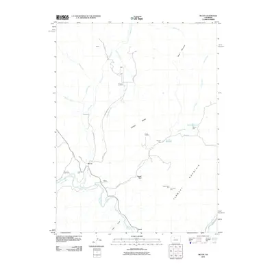
2010 Map of McCoy
USGS Topo · Published 2010About this map
The Colorado River carves through this high-altitude landscape in Eagle County, serving as the geographic anchor for the valley settlements of McCoy and Bond. This 2010 topographic record captures a ranching and mining region where industrial history is written into the terrain through features like the Copper King Mine, Copper Queen Mine, and the Rio Grande Mine. The irrigation network, including the Kayser Mutual Ditch and several reservoirs like McCoy Reservoir, illustrates the essential water management required for the Tipton Ranch and surrounding holdings. Settlement patterns are concentrated along the river and creek valleys, with the McCoy Cemetery and the rail-linked community of Copper Spur providing key landmarks for local genealogists. From the heights of Yarmony Mountain to the flats of Congor Mesa, the map details a landscape defined by its extractive economy and its proximity to the water of Rock Creek and Egeria Creek.
Find a feature on this map
38 named features on this map. Tap any name to fly to it.
Don’t see what you’re looking for? This feature index may not catch every label — zoom into the map to look around manually.
Map Details
Editions of this 2010 McCoy Map
This is the sole edition of this map. No revisions or reprints were ever made.
Other maps of this area

1954 · Craig
USGS Topo · 1:250,000

1956 · Gore Pass
USGS Topo · 1:62,500

1957 · Craig
USGS Topo · 1:250,000

1957 · Leadville
USGS Topo · 1:250,000

1958 · Craig
USGS Topo · 1:250,000

1959 · Leadville
USGS Topo · 1:250,000

1960 · Leadville
USGS Topo · 1:250,000

1960 · Craig
USGS Topo · 1:250,000

1962 · Leadville
USGS Topo · 1:250,000

1962 · Craig
USGS Topo · 1:250,000