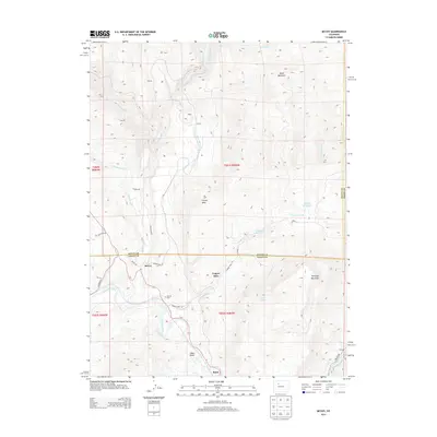
2013 Map of McCoy
USGS Topo · Published 2013About this map
The Colorado River carves through the southern reaches of this Eagle County landscape, serving as a primary corridor for both topography and transportation near the settlement of Bond. This 2013 survey illustrates a region defined by high-altitude plateaus and small mountain communities, including McCoy, Copper Spur, and the high-elevation labels of Volcano and Crater. The map provides specific locational data for local history and genealogy, noting the McCoy Cem and several water features such as Yarmony Reservoir and Egeria Creek. The infrastructure of the area is highlighted by the network of local roads like Copper Spur Rd and Trough Rd, alongside several mountain landmarks like Yarmony Mountain and Congor Mesa, which overlook the complex drainage patterns of Rock Creek and Yarmony Creek.
Find a feature on this map
37 named features on this map. Tap any name to fly to it.
Don’t see what you’re looking for? This feature index may not catch every label — zoom into the map to look around manually.
Map Details
Editions of this 2013 McCoy Map
This is the sole edition of this map. No revisions or reprints were ever made.
Other maps of this area

1954 · Craig
USGS Topo · 1:250,000

1956 · Gore Pass
USGS Topo · 1:62,500

1957 · Craig
USGS Topo · 1:250,000

1957 · Leadville
USGS Topo · 1:250,000

1958 · Craig
USGS Topo · 1:250,000

1959 · Leadville
USGS Topo · 1:250,000

1960 · Leadville
USGS Topo · 1:250,000

1960 · Craig
USGS Topo · 1:250,000

1962 · Leadville
USGS Topo · 1:250,000

1962 · Craig
USGS Topo · 1:250,000