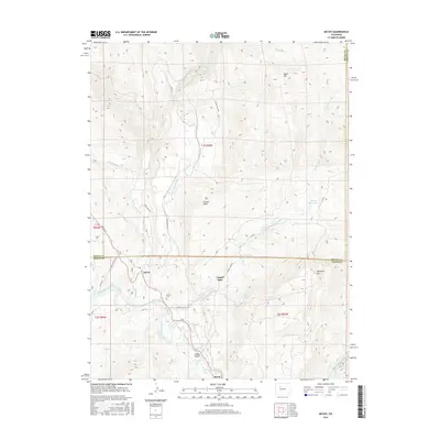
2016 Map of McCoy
USGS Topo · Published 2016About this map
The Colorado River snakes through the southern portion of this high-altitude landscape, carving a valley that supports the small communities of McCoy, Copper Spur, and Bond. This 2016 survey illustrates the concentration of human activity along the river corridor and Hwy 131, where the McCoy Cem and local infrastructure are situated. Away from the water, the terrain rises sharply toward Yarmony Mtn and Black Mtn, revealing a network of irrigation and water management features like the Kayser Mutual Ditch and Yarmony Reservoir. The map provides a clear picture of how land use is dictated by geography, with significant high-ground features such as Conger Mesa and Cabin Gulch defining the wilder, less accessible sections of the Eagle and Routt County borderlands.
Find a feature on this map
32 named features on this map. Tap any name to fly to it.
Don’t see what you’re looking for? This feature index may not catch every label — zoom into the map to look around manually.
Map Details
Editions of this 2016 McCoy Map
This is the sole edition of this map. No revisions or reprints were ever made.
Other maps of this area

1954 · Craig
USGS Topo · 1:250,000

1956 · Gore Pass
USGS Topo · 1:62,500

1957 · Craig
USGS Topo · 1:250,000

1957 · Leadville
USGS Topo · 1:250,000

1958 · Craig
USGS Topo · 1:250,000

1959 · Leadville
USGS Topo · 1:250,000

1960 · Leadville
USGS Topo · 1:250,000

1960 · Craig
USGS Topo · 1:250,000

1962 · Leadville
USGS Topo · 1:250,000

1962 · Craig
USGS Topo · 1:250,000