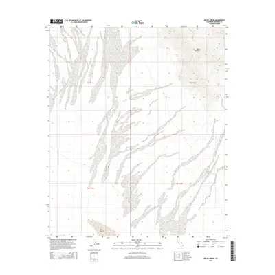
2015 Map of McCoy Spring
USGS Topo · Published 2015About this map
McCoy Mountains dominate the eastern portion of this arid landscape, providing a dramatic vertical contrast to the surrounding desert flats. The terrain is defined by its severe drainage patterns and alluvial fans that spread across the valley floor, revealing the slow geological movement of this portion of Riverside County. At the heart of these slopes, McCoy Spring appears as a critical water source in an otherwise parched environment, a point of survival that has historically dictated travel and activity in the region.
Find a feature on this map
7 named features on this map. Tap any name to fly to it.
Don’t see what you’re looking for? This feature index may not catch every label — zoom into the map to look around manually.
Map Details
Editions of this 2015 McCoy Spring Map
This is the sole edition of this map. No revisions or reprints were ever made.
Other maps of this area

1942 · Blythe
USGS Topo · 1:250,000

1945 · Midland
USGS Topo · 1:62,500

1952 · Midland
USGS Topo · 1:62,500

1952 · Mc Coy Spring
USGS Topo · 1:62,500

1952 · Sidewinder Well
USGS Topo · 1:62,500

1952 · Palen Mountains
USGS Topo · 1:62,500

1954 · Salton Sea
USGS Topo · 1:250,000

1955 · Salton Sea
USGS Topo · 1:250,000

1959 · Salton Sea
USGS Topo · 1:250,000

1963 · Salton Sea
USGS Topo · 1:250,000