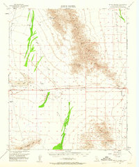
1952 Map of McCoy Spring
USGS Topo · Published 1961About this map
McCoy Spring and the rugged McCoy Mountains define this arid stretch of the California desert as it appeared in the mid-20th century. The landscape is marked by the infrastructure of water and extraction, with scattered sites like the Roosevelt Mine and various prospects hinting at the region's mineral history. The low-lying Chuckwalla Valley and Ford Dry Lake dominate the central portion of the map, illustrating the harsh hydrological realities of the Basin and Range province.
Find a feature on this map
19 named features on this map. Tap any name to fly to it.
Don’t see what you’re looking for? This feature index may not catch every label — zoom into the map to look around manually.
Map Details
Editions of this 1952 McCoy Spring Map
3 editions found
Other maps of this area

1942 · Blythe
USGS Topo · 1:250,000

1945 · Big Maria Mtns
USGS Topo · 1:62,500

1945 · Midland
USGS Topo · 1:62,500

1945 · Cibola
USGS Topo · 1:62,500

1951 · Big Maria Mts
USGS Topo · 1:62,500

1951 · McCoy Wash
USGS Topo · 1:24,000

1951 · Cibola
USGS Topo · 1:62,500

1952 · Midland
USGS Topo · 1:62,500

1952 · Mc Coy Spring
USGS Topo · 1:62,500

1952 · Sidewinder Well
USGS Topo · 1:62,500