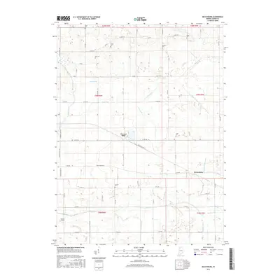
2016 Map of McCoysburg
USGS Topo · Published 2016About this map
McCoysburg and Pleasant Ridge anchor this Jasper County landscape, defined by an intricate network of drainage systems designed for agricultural productivity. The terrain is crisscrossed by numerous waterways, including the Iroquois River, Slough Creek, and several artificial channels such as Moore Ditch and Ryan Ditch. This reliance on water management is a hallmark of Northwest Indiana's development, where complex ditching converted wetlands into reliable farmland.
Find a feature on this map
65 named features on this map. Tap any name to fly to it.
Don’t see what you’re looking for? This feature index may not catch every label — zoom into the map to look around manually.
Map Details
Editions of this 2016 McCoysburg Map
This is the sole edition of this map. No revisions or reprints were ever made.
Other maps of this area

1953 · Chicago
USGS Topo · 1:250,000

1953 · Danville
USGS Topo · 1:250,000

1955 · Danville
USGS Topo · 1:250,000

1956 · Danville
USGS Topo · 1:250,000

1957 · Chicago
USGS Topo · 1:250,000

1962 · Monon
USGS Topo · 1:24,000

1962 · Medaryville
USGS Topo · 1:24,000

1962 · Gifford
USGS Topo · 1:24,000

1962 · Parr
USGS Topo · 1:24,000
1962 · Francesville
USGS Topo · 1:24,000