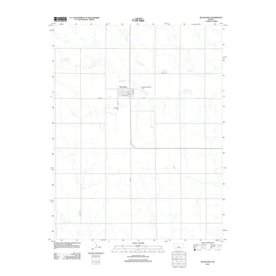
2012 Map of McCracken
USGS Topo · Published 2012About this map
The town of McCracken serves as the central hub of this High Plains landscape, situated at the intersection of local routes like Jefferson St and Railroad Ave. This 2012 depiction captures the organized grid of the settlement, noting essential civic markers such as the Po and the McCracken Wastewater Facility on the eastern edge. The surrounding terrain is defined by the winding paths of Big Timber Cr and Snake Cr, which carve through the agricultural sections of Rush County. To the south, Alexander Dry Cr cuts across the lower township, while the McCracken Cem remains a significant landmark for those researching family history in this rural Kansas community. The map illustrates a landscape of steady agricultural use, with well-defined section lines and roads like Co Rd 524 connecting remote farmsteads to the town core.
Find a feature on this map
14 named features on this map. Tap any name to fly to it.
Don’t see what you’re looking for? This feature index may not catch every label — zoom into the map to look around manually.
Map Details
Editions of this 2012 McCracken Map
This is the sole edition of this map. No revisions or reprints were ever made.
Other maps of this area

1889 · Larned
USGS Topo · 1:125,000

1891 · Larned
USGS Topo · 1:125,000

1892 · Ness
USGS Topo · 1:125,000

1893 · Ellis
USGS Topo · 1:125,000

1894 · Ness
USGS Topo · 1:125,000

1896 · Hays
USGS Topo · 1:125,000

1955 · Great Bend
USGS Topo · 1:250,000

1957 · Great Bend
USGS Topo · 1:250,000

1958 · Great Bend
USGS Topo · 1:250,000

1965 · Mc Cracken
USGS Topo · 1:24,000