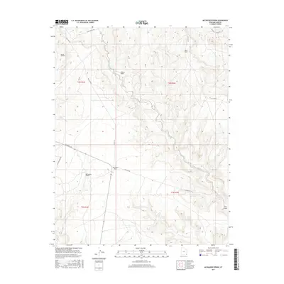
2017 Map of McCracken Spring
USGS Topo · Published 2017About this map
McCracken Spring and the expansive drainage of Alkali Creek anchor this San Juan County landscape, where the high desert is defined by a network of deep-cut canyons and elevated mesas. The cartography reveals a region shaped by both its natural topography and a sparse but deliberate network of desert roads, such as Hovenweep Rd and the evocatively named Around the World Rd. Prominent landmarks like McCracken Mesa and Alkali Point rise above the surrounding terrain, while the complex system of McCracken Canyon and Horse Canyon snakes through the plateau. This 2017 survey reflects the remote character of the Shiprock Agency area, illustrating how historic water sources like the Alkali Seep and Bullpen Swale have long served as vital points of reference in an otherwise arid environment.
Find a feature on this map
22 named features on this map. Tap any name to fly to it.
Don’t see what you’re looking for? This feature index may not catch every label — zoom into the map to look around manually.
Map Details
Editions of this 2017 McCracken Spring Map
This is the sole edition of this map. No revisions or reprints were ever made.
Other maps of this area

1886 · Abajo
USGS Topo · 1:250,000

1892 · Abajo
USGS Topo · 1:250,000

1893 · Abajo
USGS Topo · 1:250,000

1955 · Verdure 3 SE
USGS Topo · 1:24,000

1955 · Verdure 4 SW
USGS Topo · 1:24,000

1956 · Cortez
USGS Topo · 1:250,000

1957 · Aneth 1 NW
USGS Topo · 1:24,000

1957 · Monument Canyon
USGS Topo · 1:62,500

1957 · Blanding
USGS Topo · 1:62,500

1958 · Cortez
USGS Topo · 1:250,000