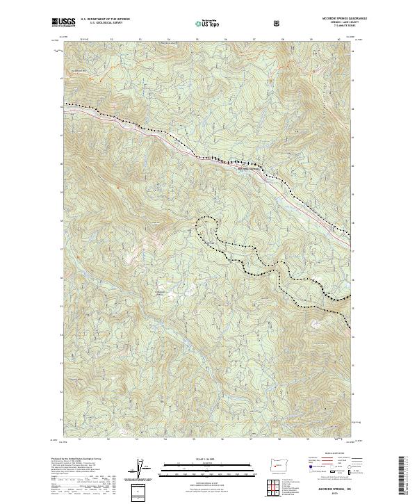
2023 Map of McCredie Springs
USGS Topo · Published 2023About this map
McCredie Springs serves as the central landmark in this mountain landscape, positioned where the waters of Salt Creek and McCredie Creek converge. The topography is defined by high ridgelines and volcanic summits, including Heckletooth Mtn and the uniquely named Slapjack Butte. This area has long been recognized for the McCredie Hot Springs, a destination that utilized the natural thermal activity found along the creek bed.
Find a feature on this map
37 named features on this map. Tap any name to fly to it.
Don’t see what you’re looking for? This feature index may not catch every label — zoom into the map to look around manually.
Map Details
Editions of this 2023 McCredie Springs Map
This is the sole edition of this map. No revisions or reprints were ever made.
Other maps of this area

1925 · Waldo Lake
USGS Topo · 1:125,000

1955 · Chucksney Mtn
USGS Topo · 1:62,500

1956 · Waldo Lake
USGS Topo · 1:62,500

1956 · Oakridge
USGS Topo · 1:62,500

1956 · Sardine Butte
USGS Topo · 1:62,500

1958 · Roseburg
USGS Topo · 1:250,000

1959 · Roseburg
USGS Topo · 1:250,000

1983 · Oakridge
USGS Topo · 1:100,000
1986 · Groundhog Mountain
USGS Topo · 1:24,000
1986 · Warner Mountain
USGS Topo · 1:24,000