Loading...
Loading map...2024 Map of McCrory
USGS Topo · Published 2024About this map
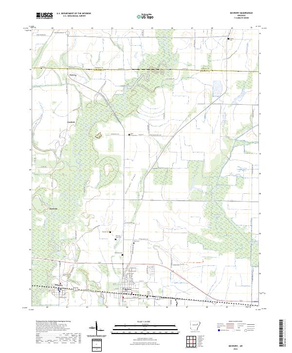
The Cache River National Wildlife Refuge dominates this section of Woodruff County, preserving a complex network of wetlands and oxbows including Hurricane Lake, White Lake, and Little Cow Lake. The landscape is a study in the intersection of federal conservation and historical agricultural settlement, where the meandering course of the Cache River is flanked by the elevated Pulltight Ridge.
Find a feature on this map
66 named features on this map. Tap any name to fly to it.
Don’t see what you’re looking for? This feature index may not catch every label — zoom into the map to look around manually.
Map Details
Date Portrayed2024
Date Published2024
PublisherU.S. Geological Survey
Map TypeTopographic
Scale1:24000
Physical Dimensions24 x 29 inches
Editions of this 2024 McCrory Map
This is the sole edition of this map. No revisions or reprints were ever made.
Historical Maps of McCrory Through Time
1 maps found
Featured Locations
Source Details
SourceU.S. Geological Survey
CopyrightPublic Domain