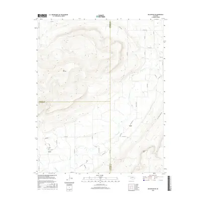
2016 Map of McCurtain SW
USGS Topo · Published 2016About this map
Sans Bois Mtn dominates the northern half of this landscape, its steep contours rising above the branching drainages of Brazil Creek and Rock Cr. This area of Latimer and Le Flore counties shows a settlement pattern of small communities like Cedar and Walls linked by a network of county roads. The terrain is defined by prominent high points including Pigeon Mtn and Rosedale Hill, while the lowlands are carved by several streams such as Owl Cr, Bear Cr, and Jefferson Cr. For local historians and genealogists, the locations of Norris Cem and Cedars Cem provide clear markers of established family ties in this corner of Oklahoma. The map also records specialized land access like the Prrd Behind Locked Gate, reflecting the mix of private land and natural topography in the mid-2010s.
Find a feature on this map
52 named features on this map. Tap any name to fly to it.
Don’t see what you’re looking for? This feature index may not catch every label — zoom into the map to look around manually.
Map Details
Editions of this 2016 McCurtain SW Map
This is the sole edition of this map. No revisions or reprints were ever made.
Other maps of this area

1900 · Sansbois
USGS Topo · 1:125,000

1900 · Sallisaw
USGS Topo · 1:125,000

1900 · Winding Stair
USGS Topo · 1:125,000

1901 · Tuskahoma
USGS Topo · 1:125,000

1908 · Tuskahoma
USGS Topo · 1:125,000

1909 · Tuskahoma
USGS Topo · 1:125,000

1909 · Winding Stair
USGS Topo · 1:125,000

1909 · Sans Bois
USGS Topo · 1:125,000

1911 · Sallisaw
USGS Topo · 1:125,000

1911 · Sansbois
USGS Topo · 1:125,000