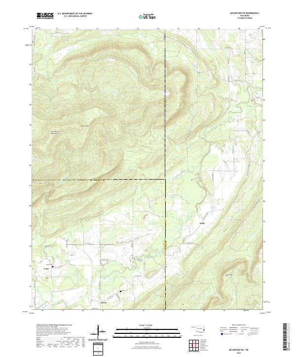
2022 Map of McCurtain SW
USGS Topo · Published 2022About this map
The Sans Bois Mountains dominate the northwestern quadrant of this terrain, where the crest of Sans Bois Mtn provides a stark contrast to the lower-lying creek valleys to the south and east. This landscape sits at a complex jurisdictional junction where the boundaries of Haskell, Latimer, and Le Flore counties converge. Settlement is concentrated along the southern corridor, particularly in the small communities of Norris and Cedar, while the village of Walls is situated further east along the banks of Brazil Creek.
Find a feature on this map
63 named features on this map. Tap any name to fly to it.
Don’t see what you’re looking for? This feature index may not catch every label — zoom into the map to look around manually.
Map Details
Editions of this 2022 McCurtain SW Map
This is the sole edition of this map. No revisions or reprints were ever made.
Other maps of this area

1900 · Sansbois
USGS Topo · 1:125,000

1900 · Sallisaw
USGS Topo · 1:125,000

1900 · Winding Stair
USGS Topo · 1:125,000

1901 · Tuskahoma
USGS Topo · 1:125,000

1908 · Tuskahoma
USGS Topo · 1:125,000

1909 · Tuskahoma
USGS Topo · 1:125,000

1909 · Winding Stair
USGS Topo · 1:125,000

1909 · Sans Bois
USGS Topo · 1:125,000

1911 · Sallisaw
USGS Topo · 1:125,000

1911 · Sansbois
USGS Topo · 1:125,000