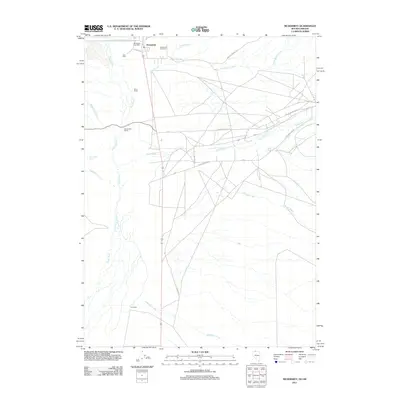
2011 Map of McDermitt
USGS Topo · Published 2011About this map
The border community of McDermitt serves as the focal point for this survey of the Nevada-Oregon state line. The settlement is centered on the McDermitt Post Office and nearby McDermitt Cemetery, which anchor the local high-desert ranching culture. The landscape is defined by the winding course of the Quinn River and a network of named waterways, including The Slough and McDermitt Creek, which sustain the various family-named agricultural operations in the basin.
Find a feature on this map
23 named features on this map. Tap any name to fly to it.
Don’t see what you’re looking for? This feature index may not catch every label — zoom into the map to look around manually.
Map Details
Editions of this 2011 McDermitt Map
This is the sole edition of this map. No revisions or reprints were ever made.
Other maps of this area

1882 · Paradise
USGS Topo · 1:250,000

1893 · Paradise
USGS Topo · 1:250,000

1955 · McDermitt
USGS Topo · 1:250,000

1955 · Jordan Valley
USGS Topo · 1:250,000

1957 · Jordan Valley
USGS Topo · 1:250,000

1958 · Jordan Valley
USGS Topo · 1:250,000

1959 · McDermitt
USGS Topo · 1:250,000

1959 · McDermitt
USGS Topo · 1:62,500

1959 · Jordan Meadow
USGS Topo · 1:62,500
1982 · Tenmile Ranch
USGS Topo · 1:24,000