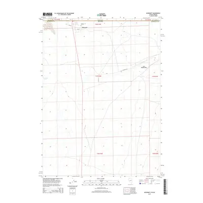
2015 Map of McDermitt
USGS Topo · Published 2015About this map
McDermitt straddles the state line in this high-desert landscape where Oregon and Nevada meet. The settlement and the nearby Fort McDermitt reservation lands occupy the Quinn River Valley, reflecting a history tied to frontier military outposts and ranching. The map highlights key local landmarks for genealogists, such as the McDermitt Cemetery and family-named routes like Albiso Dr and Lasa Dr. The terrain is defined by its arid character, with isolated water sources like Giacometto Spring providing essential resources for the area's residents and livestock. This survey details the intersection of Malheur and Humboldt counties, showing the grid of roads and land divisions that organize this sparsely populated border region, including N Reservation Rd and Big Foot Ln.
Find a feature on this map
11 named features on this map. Tap any name to fly to it.
Don’t see what you’re looking for? This feature index may not catch every label — zoom into the map to look around manually.
Map Details
Editions of this 2015 McDermitt Map
This is the sole edition of this map. No revisions or reprints were ever made.
Other maps of this area

1882 · Paradise
USGS Topo · 1:250,000

1893 · Paradise
USGS Topo · 1:250,000

1955 · McDermitt
USGS Topo · 1:250,000

1955 · Jordan Valley
USGS Topo · 1:250,000

1957 · Jordan Valley
USGS Topo · 1:250,000

1958 · Jordan Valley
USGS Topo · 1:250,000

1959 · McDermitt
USGS Topo · 1:250,000

1959 · McDermitt
USGS Topo · 1:62,500

1959 · Jordan Meadow
USGS Topo · 1:62,500
1982 · Tenmile Ranch
USGS Topo · 1:24,000