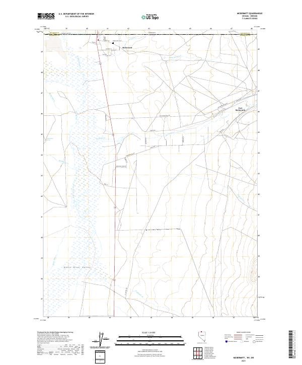
2021 Map of McDermitt
USGS Topo · Published 2021About this map
McDermitt straddles the high desert border between Nevada and Oregon, serving as a vital crossroads where the Quinn River begins to define the local geography. This high-altitude basin, known as the Quinn River Valley, is characterized by an intricate network of seasonal drainage and perennial water sources including Giacometto Spring and The Slough. The landscape reflects a long history of settlement and transit, anchored by Fort McDermitt and the nearby McDermitt Cem.
Find a feature on this map
35 named features on this map. Tap any name to fly to it.
Don’t see what you’re looking for? This feature index may not catch every label — zoom into the map to look around manually.
Map Details
Editions of this 2021 McDermitt Map
This is the sole edition of this map. No revisions or reprints were ever made.
Other maps of this area

1882 · Paradise
USGS Topo · 1:250,000

1893 · Paradise
USGS Topo · 1:250,000

1955 · McDermitt
USGS Topo · 1:250,000

1955 · Jordan Valley
USGS Topo · 1:250,000

1957 · Jordan Valley
USGS Topo · 1:250,000

1958 · Jordan Valley
USGS Topo · 1:250,000

1959 · McDermitt
USGS Topo · 1:250,000

1959 · McDermitt
USGS Topo · 1:62,500

1959 · Jordan Meadow
USGS Topo · 1:62,500
1982 · Tenmile Ranch
USGS Topo · 1:24,000