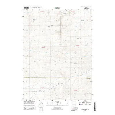
2015 Map of McDonald Ranch
USGS Topo · Published 2015About this map
McDonald Ranch anchors the southern landscape of this 2015 study, situated at the boundary of Platte and Laramie Counties. This high-plains region is defined by an intricate network of drainage systems and family-named landmarks, most notably the numerous draws that carve through the terrain, such as North Steer Draw, Mendenhal Draw, and Jacobs Draw. Water management is central to the area's geography, evidenced by the Morrison Number 2 Reservoir and Hugh McDonald Reservoir, which support the ranching operations across the Chugwater Flats. To the north, Richeau Cr and its associated Richeau Spring provide vital water sources in this arid environment. The transportation network relies on rural corridors like Iron Mountain Rd and Diamond Rd, which connect the disparate topographic features of this Wyoming ranching territory.
Find a feature on this map
31 named features on this map. Tap any name to fly to it.
Don’t see what you’re looking for? This feature index may not catch every label — zoom into the map to look around manually.
Map Details
Editions of this 2015 McDonald Ranch Map
This is the sole edition of this map. No revisions or reprints were ever made.
Other maps of this area

1953 · Natwick SW
USGS Topo · 1:24,000

1953 · Double L Ranch
USGS Topo · 1:24,000

1953 · Richeau Hills
USGS Topo · 1:24,000

1954 · Cheyenne
USGS Topo · 1:250,000

1958 · Cheyenne
USGS Topo · 1:250,000

1962 · Farthing
USGS Topo · 1:24,000

1962 · Delano Ranch
USGS Topo · 1:24,000

1962 · Bristol Ridge
USGS Topo · 1:24,000

1962 · Hirsig Ranch
USGS Topo · 1:24,000

1962 · Mc Donald Ranch
USGS Topo · 1:24,000