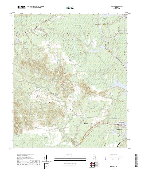
2024 Map of McDowell
USGS Topo · Published 2024About this map
The Tombigbee River and the Tennessee-Tombigbee Waterway dominate this West Alabama landscape where the boundaries of Sumter, Greene, and Marengo counties meet. The map reveals a river-driven geography characterized by numerous sandbars and bends, including Mussel Shoals Bar, Rattlesnake Bend, and Arringtons Bar. Settlement patterns are concentrated near the higher ground, with the communities of Belmont and Brownstown serving as local anchors. For those interested in local history, the map identifies several family and community burial sites such as Pinetop Cem, Taylor Cem, and Davidson Cem. The presence of the McDowell Ferry near the town of McDowell highlights the historical importance of river crossings before modern infrastructure fully bypassed these traditional transit points. Further south, the map details the expansive waters of Lake Demopolis and Prouts Lake, illustrating how the waterway system has reshaped the local environment.
Find a feature on this map
52 named features on this map. Tap any name to fly to it.
Don’t see what you’re looking for? This feature index may not catch every label — zoom into the map to look around manually.
Map Details
Editions of this 2024 McDowell Map
This is the sole edition of this map. No revisions or reprints were ever made.
Other maps of this area

1929 · Epes
USGS Topo · 1:48,000

1932 · Epes
USGS Topo · 1:62,500

1946 · Demopolis
USGS Topo · 1:24,000

1947 · Demopolis
USGS Topo · 1:24,000

1947 · Mason Bend
USGS Topo · 1:24,000

1947 · Forkland
USGS Topo · 1:24,000

1948 · Mason Bend
USGS Topo · 1:24,000

1948 · Mc Dowell
USGS Topo · 1:24,000

1949 · Mc Dowell
USGS Topo · 1:24,000

1949 · Forkland
USGS Topo · 1:24,000