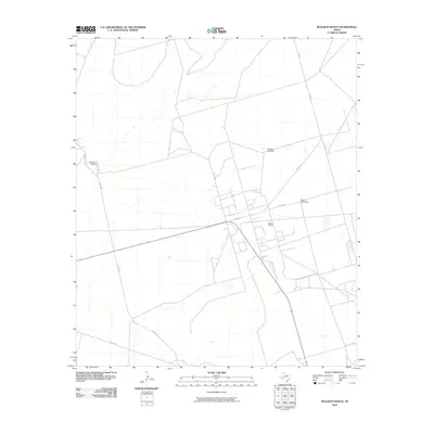
2010 Map of McElroy Ranch
USGS Topo · Published 2010About this map
The Wilshire Oil Field anchors this landscape in Upton County, reflecting the enduring industrial character of the Permian Basin region in the early twenty-first century. Sparse infrastructure connects the scattered landmarks, with Fm 1492 and Mc Elroy Ranch Rd serving as the primary arteries through the arid terrain. The presence of functional water infrastructure, including the Bomber Windmill and Shell Windmill, underscores the necessity of groundwater management for both ranching and petroleum operations.
Find a feature on this map
12 named features on this map. Tap any name to fly to it.
Don’t see what you’re looking for? This feature index may not catch every label — zoom into the map to look around manually.
Map Details
Editions of this 2010 McElroy Ranch Map
This is the sole edition of this map. No revisions or reprints were ever made.
Other maps of this area

1928 · Crane
USGS Topo · 1:125,000

1954 · Pecos
USGS Topo · 1:250,000

1957 · Pecos
USGS Topo · 1:250,000

1964 · Perkins Lake
USGS Topo · 1:24,000

1968 · Benge Corner SE
USGS Topo · 1:24,000

1968 · Benge Corner SW
USGS Topo · 1:24,000
1971 · Hanks Ranch
USGS Topo · 1:24,000

1971 · McElroy Ranch
USGS Topo · 1:24,000
1971 · Marlboro Canyon SE
USGS Topo · 1:24,000

1971 · Marlboro Canyon
USGS Topo · 1:24,000