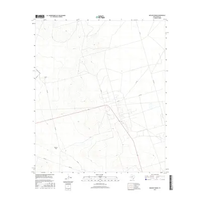
2016 Map of McElroy Ranch
USGS Topo · Published 2016About this map
McElroy Ranch anchors this portion of the Permian Basin in Upton County, situated within a landscape defined by ranching infrastructure and intermittent drainage patterns. The terrain is marked by the presence of Mayfield Draw, which cuts through the southern reaches of the quadrangle. This area of West Texas is characterized by a sparse but organized network of roads, including McElroy Ranch Rd and Ranch Rd, which facilitate movement across the expansive cattle country. The map captures the intersection of rural thoroughfares such as FM 1492 and several county-maintained routes like Co Rd 305 and Co Rd 306, illustrating the enduring spatial layout of large-scale landholdings. This 2016 survey provides a precise look at the modern boundaries and access points that define contemporary land management in this cattle-ranching region.
Find a feature on this map
10 named features on this map. Tap any name to fly to it.
Don’t see what you’re looking for? This feature index may not catch every label — zoom into the map to look around manually.
Map Details
Editions of this 2016 McElroy Ranch Map
This is the sole edition of this map. No revisions or reprints were ever made.
Other maps of this area

1928 · Crane
USGS Topo · 1:125,000

1954 · Pecos
USGS Topo · 1:250,000

1957 · Pecos
USGS Topo · 1:250,000

1964 · Perkins Lake
USGS Topo · 1:24,000

1968 · Benge Corner SE
USGS Topo · 1:24,000

1968 · Benge Corner SW
USGS Topo · 1:24,000
1971 · Hanks Ranch
USGS Topo · 1:24,000

1971 · McElroy Ranch
USGS Topo · 1:24,000
1971 · Marlboro Canyon SE
USGS Topo · 1:24,000

1971 · Marlboro Canyon
USGS Topo · 1:24,000