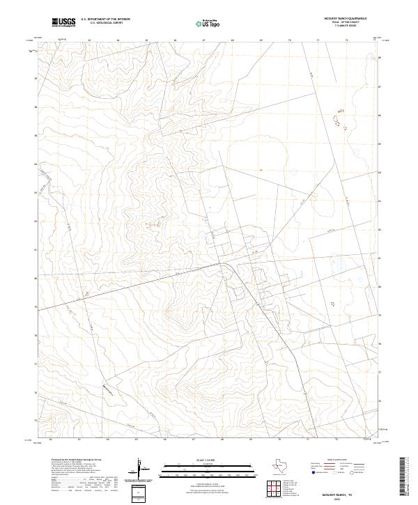
2022 Map of McElroy Ranch
USGS Topo · Published 2022About this map
Mayfield Draw winds through this West Texas landscape, defining the drainage patterns of an area dominated by ranching and oil-field infrastructure in Upton County. The map details a transition from the winding contours of the draw to the more regular grid of rural transportation routes. Significant local access is provided by McElroy Ranch Rd and Ranch Rd, while state-maintained FM 1492 cuts across the northern section of the quadrangle. This 2022 survey illustrates the contemporary arrangement of large land tracts, where numerous county roads like Co Rd 305 and Co Rd 303 navigate the subtle shifts in elevation. The presence of these named ranch and county roads reflects the ongoing importance of livestock and resource extraction in this part of the Permian Basin.
Find a feature on this map
9 named features on this map. Tap any name to fly to it.
Don’t see what you’re looking for? This feature index may not catch every label — zoom into the map to look around manually.
Map Details
Editions of this 2022 McElroy Ranch Map
This is the sole edition of this map. No revisions or reprints were ever made.
Other maps of this area

1928 · Crane
USGS Topo · 1:125,000

1954 · Pecos
USGS Topo · 1:250,000

1957 · Pecos
USGS Topo · 1:250,000

1964 · Perkins Lake
USGS Topo · 1:24,000

1968 · Benge Corner SE
USGS Topo · 1:24,000

1968 · Benge Corner SW
USGS Topo · 1:24,000
1971 · Hanks Ranch
USGS Topo · 1:24,000

1971 · McElroy Ranch
USGS Topo · 1:24,000
1971 · Marlboro Canyon SE
USGS Topo · 1:24,000

1971 · Marlboro Canyon
USGS Topo · 1:24,000